Lustrafjorden rundt - Pollen and Air Quality Forecast for Today
Pollen Today
Pollen levels today are none across the route.
Air Quality Today
Air quality along the route is good, with all pollutants at low levels. Based on Airmine's forecast, which uses satellite data to calculate exposure every 200 metres along the route, air quality is at its worst 69.2 km after start.
Route Map
Loading route map…
Environmental Exposure Detail
Lustrafjorden rundt: A 77 km route circling the Lustrafjord in Norway's Sognefjord region. It runs through natural terrain, well away from traffic and built-up areas.
Lustrafjorden rundt circles the inner Lustrafjord arm of the Sognefjord, where birch, hazel, and orchard trees line the fjord shore. The dramatically enclosed inner fjord concentrates pollen under calm conditions, while the notably dry Luster microclimate produces fewer rainfall interruptions than anywhere else in western Norway and birch peaks through April and May before grass from surrounding farmland contributes through June and July throughout this scenic inner Sognefjord running event.
Get More in Our App
Local pollen and air quality forecasts, interactive pollen maps and route profiles


Features and forecast availability vary by region.
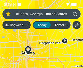
Forecast for 10 October
Pollen Forecast
| Pollen species | Level | Value |
|---|---|---|
| Alder (Alnus) | None | 0/100 |
| Birch (Betula) | None | 0/100 |
| Hazel (Corylus) | None | 0/100 |
| Cypress (Cupressaceae) | None | 0/100 |
| Grass (Poaceae) | None | 0/100 |
| Willow (Salicaceae) | None | 0/100 |
| Mugwort (Artemisia) | None | 0/100 |
Air Quality Forecast
| Pollutant | Level | Value |
|---|---|---|
| AQI | Good | 14.0/100 |
| PM2.5 (fine particles) | Good | 0.4/100 |
| PM10 (coarse particles) | Good | 0.3/100 |
| NO2 (nitrogen dioxide) | Good | 1.0/100 |
| O3 (ozone) | Good | 14.0/100 |
| SO2 (sulfur dioxide) | Good | 0.2/100 |
| CO (carbon monoxide) | Good | 0.5/100 |
| HCHO (formaldehyde) | Good | 0.3/100 |
| PM1 (ultrafine particles) | Good | 0.1/100 |
Get pollen & AQ on Strava
Follow your environmental exposure and performance with the free Airmine-Strava integration. See your pollen and air quality exposure for every Strava activity.
Resource Hub
Popular Local Routes 14 routes
Local parkruns 1 parkrun
Local events 6 events
Frequently Asked Questions
Where is air quality worst on the Lustrafjorden rundt route?
Based on today's forecast, O3 is forecast at good levels along the route today (14.0/100). Air quality is at its worst after 69.2 km into the route. Airmine calculates exposure at 200m intervals along the course using satellite-derived atmospheric data.
Where is pollen highest on the Lustrafjorden rundt course?
Pollen levels are relatively low across the entire route today. This changes through the season as different pollen species become active.
When is pollen worst during the Lustrafjorden rundt season?
Pollen seasons vary by location. Tree pollen (birch, alder) typically peaks in spring, while grass pollen rises in May-June.
How often is this forecast updated?
Updated four times daily. See the timestamp below for the most recent update.
Are pollen levels in Lustrafjorden rundt based on measurements or forecasts?
Pollen data is often misunderstood. Most "pollen levels" are not real-time measurements, but forecasts.
Direct pollen measurements are typically delayed by 1-2 days because they require manual analysis. To show current conditions in Lustrafjorden rundt, modern forecasts combine recent measurements, weather data, and information about local vegetation.
This allows us to estimate pollen levels for today and the coming days, not just report the past.
Airmine’s atmospheric monitoring platform was developed with support from the European Space Agency (ESA)’s Business Applications and Space Solutions (BASS) team, using satellite and Earth observation technologies to improve emissions monitoring.
Understanding the Scale
The 0–100 scores represent risk levels, not direct measurements of pollen or air pollutant concentrations. Higher scores indicate higher risk. Pollen and air quality use different thresholds.
Pollen
| None | 0 | No or negligible risk of exposure. Pollen/mold exposure is expected to be minimal. |
| Low | 0-25 | Low risk of exposure. Small amounts of pollen or mold spores may be present. |
| Moderate | 25-50 | Moderate risk of exposure. Pollen/mold exposure is expected to be noticeable. |
| High | 50-75 | High risk of exposure. Elevated pollen/mold exposure is expected. |
| Very High | 75-100 | Very high risk of exposure. Pollen/mold exposure is expected to be at or near its highest levels. |
Air Quality
| Good | 0-20 | Low air quality risk. Air quality is expected to be good, with low levels of pollution. |
| Fair | 20-40 | Generally low air quality risk. Air quality is expected to be acceptable, with some pollution present. |
| Moderate | 40-60 | Moderate air quality risk. Air pollution is elevated and air quality may be less favorable. |
| Poor | 60-80 | High air quality risk. Air pollution is high and air quality is expected to be poor. |
| Very Poor | 80-100 | Very high air quality risk. Air pollution is very high and air quality is expected to be very poor. |