Pollen maps
Airmine pollen maps for seamless integration on websites and customer platforms.
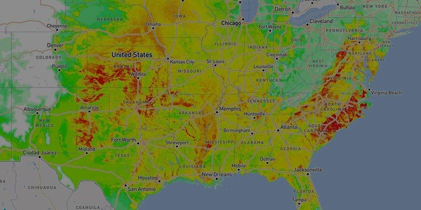
Interactive, zoomable maps are updated daily and provide pollen risk forecasts by species for today and tomorrow. Coverage includes key global markets, with maps available at both country and regional level.
“
We’re proud to have supported Airmine to harness the power of Sentinel-2 to improve pollen forecasting. This is a great example of how satellite technology can be at the heart of services that create healthier places to live and work – a central aim of our Space for Smart and Green Cities Task Force initiative