Platypus, Fig Tree Pocket Air Quality Forecast - Today, Tomorrow

Air Quality Today

Good 20/100

Today (16 October): Air quality in Platypus is good. AQI, PM2.5, PM10, NO2, O3, SO2, CO, HCHO, and PM1 are good. Pollution peaks around 12:00 AM (PM2.5: 25.0/100).

Air Quality Tomorrow

Good 17/100

Tomorrow (17 October 2026): Air quality in Platypus is good. All pollutants stay as today. Pollution peaks around 5:00 PM (PM2.5: 23.1/100).

Updated: 16 October 2026 at 10:04 CEST
Country: Australia

Explore Forecasts

Routes in Fig Tree Pocket

82 routes in Fig Tree Pocket

Bracalba Shared Trail 7.1 km Pollen Air quality Cabbage Tree Range Loop 16.1 km Pollen Air quality Goanna Trail 1.7 km Pollen Air quality Gold Coast Hinterland Great Walk 47.2 km Pollen Air quality Oxfam Trailwalker Brisbane 16.2 km Pollen Air quality QUT to New Farm 5.1 km Pollen Air quality Roses circuit 6.4 km Pollen Air quality Seven Hills Circuit 2.2 km Pollen Air quality Sunshine Coast Hinterland Great Walk 47.4 km Pollen Air quality Tingalpa Creek Circuit 2.7 km Pollen Air quality Venman Circuit 7.5 km Pollen Air quality Baringa parkrun 5 km Pollen Air quality Bellevue Park junior parkrun 2 km Pollen Air quality Birtinya Island parkrun 5 km Pollen Air quality Brightwater parkrun 5 km Pollen Air quality Broadbeach Waters parkrun 5 km Pollen Air quality Bunyaville parkrun 5 km Pollen Air quality Calamvale parkrun 5 km Pollen Air quality Capalaba parkrun 5 km Pollen Air quality Capestone Lake parkrun 5 km Pollen Air quality Chermside parkrun 5 km Pollen Air quality Cleveland parkrun 5 km Pollen Air quality Coomera parkrun 5 km Pollen Air quality Cormorant Bay parkrun 5 km Pollen Air quality Des Connor Park junior parkrun 2 km Pollen Air quality Forest Lake parkrun 5 km Pollen Air quality Gainsborough Parklands parkrun 5 km Pollen Air quality Gatton parkrun 5 km Pollen Air quality Glass House Mountains Conservation parkrun 5 km Pollen Air quality Golden Beach parkrun 5 km Pollen Air quality Greenbank parkrun 5 km Pollen Air quality Greenheart Robina Parklands parkrun 5 km Pollen Air quality Harmony Boulevard parkrun 5 km Pollen Air quality Harris Avenue parkrun 5 km Pollen Air quality Hidden Vale parkrun 5 km Pollen Air quality Ipswich QLD parkrun 5 km Pollen Air quality Jeune Park parkrun 5 km Pollen Air quality Kawana parkrun 5 km Pollen Air quality Kedron parkrun 5 km Pollen Air quality Kelvin Grove parkrun 5 km Pollen Air quality Kirra parkrun 5 km Pollen Air quality Logan River parkrun 5 km Pollen Air quality Lota parkrun 5 km Pollen Air quality Main Beach parkrun 5 km Pollen Air quality Mansfield parkrun, Queensland 5 km Pollen Air quality Meadowbrook parkrun 5 km Pollen Air quality Minnippi parkrun 5 km Pollen Air quality Mitchelton parkrun 5 km Pollen Air quality Mudgeeraba parkrun 5 km Pollen Air quality Nathan Road Sports Ground parkrun 5 km Pollen Air quality New Farm parkrun 5 km Pollen Air quality North Harbour parkrun 5 km Pollen Air quality North Lakes parkrun 5 km Pollen Air quality Ocean View parkrun 5 km Pollen Air quality Old Esk Railway Station parkrun 5 km Pollen Air quality Pallara parkrun 5 km Pollen Air quality Picnic Point Parklands parkrun 5 km Pollen Air quality Redcliffe parkrun 5 km Pollen Air quality Redland Bay parkrun 5 km Pollen Air quality Robelle Domain parkrun 5 km Pollen Air quality Rocks Riverside parkrun 5 km Pollen Air quality Samford Parklands parkrun 5 km Pollen Air quality Sandgate parkrun 5 km Pollen Air quality Scribbly Gums Conservation parkrun 5 km Pollen Air quality Sirromet parkrun 5 km Pollen Air quality South Bank parkrun 5 km Pollen Air quality South Toowoomba parkrun 5 km Pollen Air quality St Lucia parkrun 5 km Pollen Air quality Stones Corner parkrun 5 km Pollen Air quality Surfers Paradise parkrun 5 km Pollen Air quality Tamborine Mountain parkrun 5 km Pollen Air quality Toowoomba parkrun 5 km Pollen Air quality Varsity Lakes parkrun 5 km Pollen Air quality White Rock parkrun 5 km Pollen Air quality Wynnum parkrun 5 km Pollen Air quality Yarrabilba parkrun 5 km Pollen Air quality Yowie parkrun 5 km Pollen Air quality Gold Coast Half Marathon 21 km Pollen Air quality Gold Coast Marathon 42 km Pollen Air quality Gold Coast Marathon 10K 10 km Pollen Air quality Sunshine Coast Marathon Festival 42 km Pollen Air quality Toowoomba Running Festival Half Marathon 21 km Pollen Air quality

Get More in Our App

Local pollen and air quality forecasts, interactive pollen maps and route profiles

Download on the App Store Get it on Google Play

Features and forecast availability vary by region.
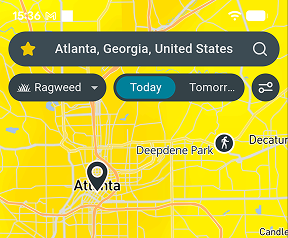
Airmine app pollen map

Air Quality

Today - 16 October

Pollutant Level Value
AQI
Good
19.7/100
PM2.5 (fine particles)
Good
19.7/100
PM10 (coarse particles)
Good
13.9/100
NO2 (nitrogen dioxide)
Good
8.8/100
O3 (ozone)
Good
9.2/100
SO2 (sulfur dioxide)
Good
1.5/100
CO (carbon monoxide)
Good
0.3/100
HCHO (formaldehyde)
Good
1.1/100
PM1 (ultrafine particles)
Good
1.9/100

Tomorrow - 17 October

Pollutant Level Value
AQI
Good
16.5/100
PM2.5 (fine particles)
Good
16.5/100
PM10 (coarse particles)
Good
11.7/100
NO2 (nitrogen dioxide)
Good
5.3/100
O3 (ozone)
Good
10.5/100
SO2 (sulfur dioxide)
Good
1.2/100
CO (carbon monoxide)
Good
0.3/100
HCHO (formaldehyde)
Good
1.4/100
PM1 (ultrafine particles)
Good
1.6/100
ENVIRONMENT & ANALYSIS

Local Environmental Conditions

Around this site in Fig Tree Pocket, a mix of built-up land and open space means traffic is an important, but not overwhelming, local pollution source. Trees nearby help filter some particles from the air, though in hot weather they also emit compounds that feed ozone formation. Air arriving from elsewhere in the region adds to what is produced locally.

In the mildest months, June to August, calmer nights at around 16°C allow traffic pollution to build up near the ground. By contrast, warm, sunny weather from October to April, around 25°C at its peak, raises afternoon ozone levels. Wildfire smoke is most likely from August to September, sometimes turning the sky hazy for days. Breezy weather in February, with winds near 15 km/h, tends to sweep pollution away.

Get pollen & AQ on Strava

Follow your environmental exposure and performance with the free Airmine-Strava integration. See your pollen and air quality exposure for every Strava activity.

Resource Hub

Pollen forecasts for Fig Tree Pocket Mold forecasts for Fig Tree Pocket
Air quality forecast neighborhoods 20 neighborhoods
Popular Local Routes 11 routes
Local parkruns 66 parkruns
Baringa parkrun 5 km
Pollen Air quality
Bellevue Park junior parkrun 2 km
Pollen Air quality
Birtinya Island parkrun 5 km
Pollen Air quality
Brightwater parkrun 5 km
Pollen Air quality
Broadbeach Waters parkrun 5 km
Pollen Air quality
Local events 5 events

Frequently Asked Questions About Air Quality in Queensland

Is air quality bad in Platypus right now?

On 16 October 2026, overall air quality in Platypus is good. AQI is the main air quality indicator at 19.7/100. Pollution peaks around 12:00 AM (PM2.5: 25.0/100).

Will air quality be worse tomorrow in Platypus?

On 17 October 2026, air quality conditions in Platypus will be similar to today, with AQI forecast at good at 16.5/100. Pollution peaks around 5:00 PM (PM2.5: 23.1/100).

When is air pollution at its worst in Platypus?

In the mildest months, June to August, calmer nights at around 16°C allow traffic pollution to build up near the ground. By contrast, warm, sunny weather from October to April, around 25°C at its peak, raises afternoon ozone levels. Wildfire smoke is most likely from August to September, sometimes turning the sky hazy for days. Breezy weather in February, with winds near 15 km/h, tends to sweep pollution away.

Are air quality levels in Platypus based on measurements or forecasts?

It is forecasts derived by downscaling forecasts provided by EU’s Copernicus Atmosphere Monitoring Service (CAMS) by taking into account local conditions such as traffic patterns. CAMS bases its forecast on satellite measurements of particles and chemical compounds in the atmosphere. Airmine’s services were developed with support from the European Space Agency (ESA)’s Business Applications and Space Solutions (BASS) team.

Why doesn’t the forecast always reflect wildfire impacts?

Airmine’s forecast uses CAMS (Copernicus Atmosphere Monitoring Service) as its background atmospheric model. While CAMS includes wildfire emissions, these are derived from satellite observations and are not available in real time. During rapidly evolving wildfire events, there may therefore be a delay before increased emissions are incorporated into the model. As a result, the forecast may temporarily underestimate PM₂.₅ and other pollutants associated with wildfire smoke.

During rapidly evolving wildfire events, CAMS may lag by approximately 1–2 days before increased wildfire emissions are fully represented, which can lead to temporary underestimation of PM₂.₅ concentrations in Airmine’s forecast.

Understanding the Scale

The 0–100 air quality scores represent risk levels, not direct air pollutant concentrations. Higher scores indicate higher risk.

Air Quality

Good
0-20 Low air quality risk. Air quality is expected to be good, with low levels of pollution.
Fair
20-40 Generally low air quality risk. Air quality is expected to be acceptable, with some pollution present.
Moderate
40-60 Moderate air quality risk. Air pollution is elevated and air quality may be less favorable.
Poor
60-80 High air quality risk. Air pollution is high and air quality is expected to be poor.
Very Poor
80-100 Very high air quality risk. Air pollution is very high and air quality is expected to be very poor.

Airmine’s atmospheric monitoring platform was developed with support from the European Space Agency (ESA)’s Business Applications and Space Solutions (BASS) team, using satellite and Earth observation technologies to improve emissions monitoring. This page provides the latest public air quality forecast for Fig Tree Pocket.

Data provided by Airmine — Last update: 16 October 2026 at 10:04 CEST (Data is updated four times daily.)

Methodology & Technology

Airmine combines satellite observations, weather forecasts and machine learning to forecast pollen, air quality and mold risk. For pollen, vegetation maps and weather data help predict season onset and exposure at 400 × 400 metre resolution. For air quality, we refine Copernicus CAMS forecasts using local factors such as roads, emissions and terrain. For routes, data is updated dynamically to provide accurate exposure metrics along the specific race corridor coordinates.

Our models are calibrated against millions of professional monitoring records and updated four times daily as new data becomes available.

Unless stated otherwise, this content is Airmine’s sole responsibility and has not been paid for by external organisations.

Disclaimer

The information provided is for environmental awareness only and does not constitute medical advice. Athletes with known respiratory conditions or severe allergies should consult their physician before participating in strenuous outdoor activities based on these forecasts.

Some text on this page may be generated or summarised using artificial intelligence (AI). Wherever possible, AI-generated content is enriched with Airmine's proprietary data to improve its accuracy and relevance. However, AI-generated content may still contain errors, omissions, or inaccuracies.