Pump Hole Viewpoint, Crows Nest Air Quality Forecast - Today, Tomorrow
Air Quality Today
Today (16 October): Air quality in Pump Hole Viewpoint is good. AQI, PM2.5, PM10, NO2, O3, SO2, CO, HCHO, and PM1 are good. Pollution peaks around 12:00 PM (PM2.5: 20.3/100).
Air Quality Tomorrow
Tomorrow (17 October 2026): Air quality in Pump Hole Viewpoint is good. All pollutants stay as today. Pollution peaks around 5:00 PM (PM2.5: 23.8/100).
Explore Forecasts
Pollen & Mold
Air Quality for Neighborhoods
Pollen & AQ for Routes
Get More in Our App
Local pollen and air quality forecasts, interactive pollen maps and route profiles


Features and forecast availability vary by region.
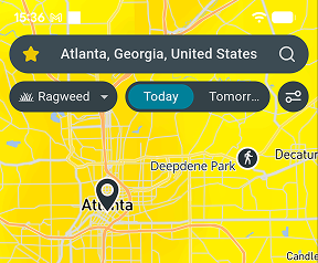
Air Quality
Today - 16 October
| Pollutant | Level | Value |
|---|---|---|
| AQI | Good | 14.3/100 |
| PM2.5 (fine particles) | Good | 13.9/100 |
| PM10 (coarse particles) | Good | 9.4/100 |
| NO2 (nitrogen dioxide) | Good | 7.1/100 |
| O3 (ozone) | Good | 10.1/100 |
| SO2 (sulfur dioxide) | Good | 1.1/100 |
| CO (carbon monoxide) | Good | 0.3/100 |
| HCHO (formaldehyde) | Good | 1.2/100 |
| PM1 (ultrafine particles) | Good | 5.7/100 |
Tomorrow - 17 October
| Pollutant | Level | Value |
|---|---|---|
| AQI | Good | 13.6/100 |
| PM2.5 (fine particles) | Good | 13.0/100 |
| PM10 (coarse particles) | Good | 8.8/100 |
| NO2 (nitrogen dioxide) | Good | 4.7/100 |
| O3 (ozone) | Good | 10.6/100 |
| SO2 (sulfur dioxide) | Good | 0.9/100 |
| CO (carbon monoxide) | Good | 0.3/100 |
| HCHO (formaldehyde) | Good | 1.4/100 |
| PM1 (ultrafine particles) | Good | 4.9/100 |
Local Environmental Conditions
This part of Crows Nest lies in a lightly developed area, where local traffic adds relatively little to air pollution. The surrounding woodland releases natural compounds that, in warm sunny weather, help form ozone. On some days, pollution drifting in from farther away outweighs local sources. Exhaust from nearby roads is usually highest close to busy streets and junctions.
Ozone is the main concern from October to March, when sunny days averaging 24°C turn traffic and other emissions into ozone by mid-afternoon. In the mildest months, June to August, calmer nights at around 12°C allow traffic pollution to build up near the ground. February is usually the windiest month, averaging about 15 km/h, which helps keep the air clean.
Get pollen & AQ on Strava
Follow your environmental exposure and performance with the free Airmine-Strava integration. See your pollen and air quality exposure for every Strava activity.
Resource Hub
Air quality forecast neighborhoods 10 neighborhoods
Sports venues in Crows Nest 1 sports venue
Popular Local Routes 5 routes
Local parkruns 32 parkruns
Local events 1 event
Frequently Asked Questions About Air Quality in Queensland
Is air quality bad in Pump Hole Viewpoint right now?
On 16 October 2026, overall air quality in Pump Hole Viewpoint is good. AQI is the main air quality indicator at 14.3/100. Pollution peaks around 12:00 PM (PM2.5: 20.3/100).
Will air quality be worse tomorrow in Pump Hole Viewpoint?
On 17 October 2026, air quality conditions in Pump Hole Viewpoint will be similar to today, with AQI forecast at good at 13.6/100. Pollution peaks around 5:00 PM (PM2.5: 23.8/100).
When is air pollution at its worst in Pump Hole Viewpoint?
Ozone is the main concern from October to March, when sunny days averaging 24°C turn traffic and other emissions into ozone by mid-afternoon. In the mildest months, June to August, calmer nights at around 12°C allow traffic pollution to build up near the ground. February is usually the windiest month, averaging about 15 km/h, which helps keep the air clean.
Are air quality levels in Pump Hole Viewpoint based on measurements or forecasts?
It is forecasts derived by downscaling forecasts provided by EU’s Copernicus Atmosphere Monitoring Service (CAMS) by taking into account local conditions such as traffic patterns. CAMS bases its forecast on satellite measurements of particles and chemical compounds in the atmosphere. Airmine’s services were developed with support from the European Space Agency (ESA)’s Business Applications and Space Solutions (BASS) team.
Why doesn’t the forecast always reflect wildfire impacts?
Airmine’s forecast uses CAMS (Copernicus Atmosphere Monitoring Service) as its background atmospheric model. While CAMS includes wildfire emissions, these are derived from satellite observations and are not available in real time. During rapidly evolving wildfire events, there may therefore be a delay before increased emissions are incorporated into the model. As a result, the forecast may temporarily underestimate PM₂.₅ and other pollutants associated with wildfire smoke.
During rapidly evolving wildfire events, CAMS may lag by approximately 1–2 days before increased wildfire emissions are fully represented, which can lead to temporary underestimation of PM₂.₅ concentrations in Airmine’s forecast.
Understanding the Scale
The 0–100 air quality scores represent risk levels, not direct air pollutant concentrations. Higher scores indicate higher risk.
Air Quality
| Good | 0-20 | Low air quality risk. Air quality is expected to be good, with low levels of pollution. |
| Fair | 20-40 | Generally low air quality risk. Air quality is expected to be acceptable, with some pollution present. |
| Moderate | 40-60 | Moderate air quality risk. Air pollution is elevated and air quality may be less favorable. |
| Poor | 60-80 | High air quality risk. Air pollution is high and air quality is expected to be poor. |
| Very Poor | 80-100 | Very high air quality risk. Air pollution is very high and air quality is expected to be very poor. |