Wyndham Vale, City of Wyndham Air Quality Forecast - Today, Tomorrow

Air Quality Today

Fair 21/100

Today (13 October): Air quality in Wyndham Vale is fair. AQI and PM2.5 are fair; PM10, NO2, O3, SO2, CO, HCHO, and PM1 are good. Pollution peaks around 3:00 PM (PM2.5: 25.5/100).

Air Quality Tomorrow

Fair 29/100

Tomorrow (14 October 2026): Air quality in Wyndham Vale is fair. PM10 increases to fair; all other pollutants stay as today. Pollution peaks around 12:00 PM (PM2.5: 38.6/100).

Updated: 13 October 2026 at 14:50 CEST
Country: Australia

Explore Forecasts

Routes in City of Wyndham

75 routes in City of Wyndham

Aintree Reserve junior parkrun 2 km Pollen Air quality Aintree Reserve parkrun 5 km Pollen Air quality Albert Park parkrun 5 km Pollen Air quality Aurora parkrun 5 km Pollen Air quality Balyang Sanctuary parkrun 5 km Pollen Air quality Bannockburn Bush parkrun 5 km Pollen Air quality Belvedere parkrun 5 km Pollen Air quality Berwick Springs parkrun 5 km Pollen Air quality Berwick Waters parkrun 5 km Pollen Air quality Birdsland Reserve parkrun 5 km Pollen Air quality Brimbank parkrun 5 km Pollen Air quality Calembeen parkrun 5 km Pollen Air quality Campaspe parkrun 5 km Pollen Air quality Chelsea Bicentennial parkrun 5 km Pollen Air quality Coburg parkrun 5 km Pollen Air quality Cruickshank Park parkrun 5 km Pollen Air quality Dandenong parkrun 5 km Pollen Air quality Darebin parkrun 5 km Pollen Air quality De Soza parkrun 5 km Pollen Air quality Diamond Creek parkrun 5 km Pollen Air quality Dixon Field parkrun 5 km Pollen Air quality Dorset Recreation Reserve parkrun 5 km Pollen Air quality Eastern Gardens parkrun 5 km Pollen Air quality Emerald Lake parkrun 5 km Pollen Air quality Frankston Nature Conservation Reserve parkrun 5 km Pollen Air quality Frog Hollow parkrun 5 km Pollen Air quality Gardiners Creek parkrun 5 km Pollen Air quality Hastings Foreshore parkrun 5 km Pollen Air quality Highlands parkrun 5 km Pollen Air quality Jells parkrun 5 km Pollen Air quality Karkarook parkrun 5 km Pollen Air quality Kilmore Racecourse Walking Track parkrun 5 km Pollen Air quality Kirkdale Reserve parkrun 5 km Pollen Air quality KM Reedy Reserve parkrun 5 km Pollen Air quality Lalor parkrun 5 km Pollen Air quality Lancefield parkrun 5 km Pollen Air quality Lewis Park Reserve parkrun 5 km Pollen Air quality Lillydale Lake parkrun 5 km Pollen Air quality Maribyrnong parkrun 5 km Pollen Air quality Maroondah Dam parkrun 5 km Pollen Air quality Marriott Waters parkrun 5 km Pollen Air quality Mernda parkrun 5 km Pollen Air quality Mullum Mullum parkrun 5 km Pollen Air quality Newport Lakes parkrun 5 km Pollen Air quality Ocean Grove parkrun 5 km Pollen Air quality Pakenham parkrun 5 km Pollen Air quality Parkville parkrun 5 km Pollen Air quality Peppertree parkrun 5 km Pollen Air quality Point Cook parkrun 5 km Pollen Air quality Portarlington parkrun 5 km Pollen Air quality Prince of Wales parkrun 5 km Pollen Air quality Red Hill Rail Trail parkrun 5 km Pollen Air quality Rosebud parkrun 5 km Pollen Air quality Sunbury parkrun 5 km Pollen Air quality The Phar Lap Track parkrun 5 km Pollen Air quality Torquay parkrun 5 km Pollen Air quality Trebeck Reserve parkrun 5 km Pollen Air quality Victory Road Reserve parkrun 5 km Pollen Air quality Wallaby Track parkrun 5 km Pollen Air quality Warrandyte River Reserve parkrun 5 km Pollen Air quality Warringal Parklands parkrun 5 km Pollen Air quality Westerfolds junior parkrun 2 km Pollen Air quality Westerfolds parkrun 5 km Pollen Air quality Wilson Botanic parkrun 5 km Pollen Air quality You Yangs parkrun 5 km Pollen Air quality Around The Bay Cycle - 100km 100 km Pollen Air quality Around The Bay Cycle - 50km 50 km Pollen Air quality Around The Bay Cycle - Family Ride 17 km Pollen Air quality Around The Bay Cycle - The Classic 220 km Pollen Air quality Ballarat Marathon 42 km Pollen Air quality Great Aussie Hike 43 km Pollen Air quality Great Ocean Road Running Festival Marathon 44 km Pollen Air quality Melbourne Half Marathon 21K 21 km Pollen Air quality Melbourne Marathon 42 km Pollen Air quality Run Melbourne Half Marathon 21 km Pollen Air quality

Get More in Our App

Local pollen and air quality forecasts, interactive pollen maps and route profiles

Download on the App Store Get it on Google Play

Features and forecast availability vary by region.
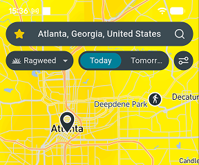
Airmine app pollen map

Air Quality

Today - 13 October

Pollutant Level Value
AQI
Fair
21.5/100
PM2.5 (fine particles)
Fair
21.5/100
PM10 (coarse particles)
Good
16.6/100
NO2 (nitrogen dioxide)
Good
4.4/100
O3 (ozone)
Good
8.3/100
SO2 (sulfur dioxide)
Good
0.9/100
CO (carbon monoxide)
Good
0.3/100
HCHO (formaldehyde)
Good
0.6/100
PM1 (ultrafine particles)
Good
1.5/100

Tomorrow - 14 October

Pollutant Level Value
AQI
Fair
28.6/100
PM2.5 (fine particles)
Fair
28.6/100
PM10 (coarse particles)
Fair
21.2/100
NO2 (nitrogen dioxide)
Good
5.0/100
O3 (ozone)
Good
8.6/100
SO2 (sulfur dioxide)
Good
0.8/100
CO (carbon monoxide)
Good
0.3/100
HCHO (formaldehyde)
Good
0.6/100
PM1 (ultrafine particles)
Good
2.3/100
ENVIRONMENT & ANALYSIS

Local Environmental Conditions

Around this site in City of Wyndham, dense development means road traffic is the main local source of nitrogen dioxide and fine particles. Pockets of trees and green space help filter a small share of the particles from traffic. Winds here are fairly strong, averaging around 20 km/h, which helps disperse local pollution. Air arriving from elsewhere in the region adds to what is produced locally.

Summer sun in January cooks traffic fumes into ozone, especially in the warmest month, which averages 20°C. From June to August, temperatures near 9°C let smoke and particles from home heating and traffic build up, especially on cold, still mornings. September is usually the windiest month, averaging about 20 km/h, which helps keep the air clean.

Get pollen & AQ on Strava

Follow your environmental exposure and performance with the free Airmine-Strava integration. See your pollen and air quality exposure for every Strava activity.

Resource Hub

Pollen forecasts for City of Wyndham Mold forecasts for City of Wyndham
Air quality forecast neighborhoods 16 neighborhoods
Local parkruns 65 parkruns
Aintree Reserve junior parkrun 2 km
Pollen Air quality
Aintree Reserve parkrun 5 km
Pollen Air quality
Albert Park parkrun 5 km
Pollen Air quality
Aurora parkrun 5 km
Pollen Air quality
Balyang Sanctuary parkrun 5 km
Pollen Air quality
Local events 10 events

Frequently Asked Questions About Air Quality in Victoria

Is air quality bad in Wyndham Vale right now?

On 13 October 2026, overall air quality in Wyndham Vale is fair. AQI is the main air quality indicator at 21.5/100. Pollution peaks around 3:00 PM (PM2.5: 25.5/100).

Will air quality be worse tomorrow in Wyndham Vale?

On 14 October 2026, air quality conditions in Wyndham Vale will be similar to today, with AQI forecast at fair at 28.6/100. Pollution peaks around 12:00 PM (PM2.5: 38.6/100).

When is air pollution at its worst in Wyndham Vale?

Summer sun in January cooks traffic fumes into ozone, especially in the warmest month, which averages 20°C. From June to August, temperatures near 9°C let smoke and particles from home heating and traffic build up, especially on cold, still mornings. September is usually the windiest month, averaging about 20 km/h, which helps keep the air clean.

Are air quality levels in Wyndham Vale based on measurements or forecasts?

It is forecasts derived by downscaling forecasts provided by EU’s Copernicus Atmosphere Monitoring Service (CAMS) by taking into account local conditions such as traffic patterns. CAMS bases its forecast on satellite measurements of particles and chemical compounds in the atmosphere. Airmine’s services were developed with support from the European Space Agency (ESA)’s Business Applications and Space Solutions (BASS) team.

Why doesn’t the forecast always reflect wildfire impacts?

Airmine’s forecast uses CAMS (Copernicus Atmosphere Monitoring Service) as its background atmospheric model. While CAMS includes wildfire emissions, these are derived from satellite observations and are not available in real time. During rapidly evolving wildfire events, there may therefore be a delay before increased emissions are incorporated into the model. As a result, the forecast may temporarily underestimate PM₂.₅ and other pollutants associated with wildfire smoke.

During rapidly evolving wildfire events, CAMS may lag by approximately 1–2 days before increased wildfire emissions are fully represented, which can lead to temporary underestimation of PM₂.₅ concentrations in Airmine’s forecast.

Understanding the Scale

The 0–100 air quality scores represent risk levels, not direct air pollutant concentrations. Higher scores indicate higher risk.

Air Quality

Good
0-20 Low air quality risk. Air quality is expected to be good, with low levels of pollution.
Fair
20-40 Generally low air quality risk. Air quality is expected to be acceptable, with some pollution present.
Moderate
40-60 Moderate air quality risk. Air pollution is elevated and air quality may be less favorable.
Poor
60-80 High air quality risk. Air pollution is high and air quality is expected to be poor.
Very Poor
80-100 Very high air quality risk. Air pollution is very high and air quality is expected to be very poor.

Airmine’s atmospheric monitoring platform was developed with support from the European Space Agency (ESA)’s Business Applications and Space Solutions (BASS) team, using satellite and Earth observation technologies to improve emissions monitoring. This page provides the latest public air quality forecast for City of Wyndham.

Data provided by Airmine — Last update: 13 October 2026 at 14:50 CEST (Data is updated four times daily.)

Methodology & Technology

Airmine combines satellite observations, weather forecasts and machine learning to forecast pollen, air quality and mold risk. For pollen, vegetation maps and weather data help predict season onset and exposure at 400 × 400 metre resolution. For air quality, we refine Copernicus CAMS forecasts using local factors such as roads, emissions and terrain. For routes, data is updated dynamically to provide accurate exposure metrics along the specific race corridor coordinates.

Our models are calibrated against millions of professional monitoring records and updated four times daily as new data becomes available.

Unless stated otherwise, this content is Airmine’s sole responsibility and has not been paid for by external organisations.

Disclaimer

The information provided is for environmental awareness only and does not constitute medical advice. Athletes with known respiratory conditions or severe allergies should consult their physician before participating in strenuous outdoor activities based on these forecasts.

Some text on this page may be generated or summarised using artificial intelligence (AI). Wherever possible, AI-generated content is enriched with Airmine's proprietary data to improve its accuracy and relevance. However, AI-generated content may still contain errors, omissions, or inaccuracies.